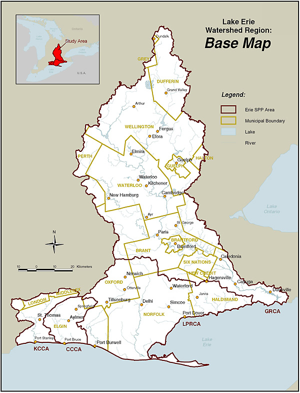
Source Protection Areas
Lake Erie Source Protection Region
Lake Erie Source Protection Region is one of 19 created by the Clean Water Act 2006. Read important background information covering the policies and programs, how the plans are implemented, and more.
The region includes four watersheds, which are known as Source Protection Areas under the Act:
- Catfish Creek Source Protection Area
- Grand River Source Protection Area
- Kettle Creek Source Protection Area
- Long Point Region Source Protection Area
The region covers an area from St. Thomas in the west to Dunnville in the east and as far north as Dundalk.
There are 52 municipalities and two First Nations within the region and 63 drinking water systems, serving about 900,000 people. Each Source Protection Area has its own drinking water source protection plan.
Administration
The Lake Erie Region Source Protection Committee oversees the development of the plans and reports on policy implementation.
This is a multi-stakeholder committee representing those with an interest in drinking water issues including municipalities, residents, farmers, businesses and others.
The day-to-day business of the source protection planning process is in the hands of a program manager and program assistant. They are supported by staff from the four conservation authorities in the Lake Erie Region.
Go to our Contact Us page for more information.
Contact Us
Lake Erie Source Protection Region
c/o Grand River Conservation Authority
400 Clyde Road, PO Box 729
Cambridge ON. N1R 5W6
Phone: 519-621-2761
Fax: 519-621-4844
info@sourcewater.ca
Read our latest news
Stay up to date on our latest news.